A geospatial approach to climate resilient wastewater flow separation: a case study by Atkins
Surface water is likely to become a greater concern due to climatic changes, with an increase in extreme weather leading to higher intensity rainfall and a parallel increase in peak flow redundancy heightening the risk of flooding and pollution from combined sewer overflows.
Consequently, surface water flow is under greater scrutiny than ever before by both planners and Water Utilities as they seek sustainable solutions for structural drainage demands and future planning – Therefore, Water Utility providers must scrutinise solutions for surface flow more closely.
Spatial Holds the Answer
To respond to this challenge, spatial analytics can be leveraged in new ways both for utility providers the wider planning sector, to integrate surface water management as a central component of natural capital and social value planning.
Spatial solutions are an ideal way to address a multi-disciplinary problem such as surface water management or ‘sponge city’ solutions, particularly as geospatial specialists frequently cover multiple sectors (within Atkins Geospatial Team, for example, it’s common for a GIS (Geographic Information System) Analyst to have a history of working with ecologists, landscape specialists, planners, hydrologists and engineers).
These disciplines have highly varied data and vocabulary, but when their projects revolve around assets with a shared location, the multilingual abilities of GIS come to the fore: data on flooding, socioeconomics, topography, surface cover, building types, land ownership types, energy use and broader factor can all be analysed centrally for a solution that’s beneficial to all.
The Thames Water Drainage Wastewater Management Plan
In one recent example, data and automation proved pivotal to accurately defining surface water solutions as part of the drainage surface waste management plan (DWMP) for Thames Water to help tackle flooding, protect homes and reduce storm overflow discharges.
Sustainable drainage systems (SuDS) opportunities were identified using Atkins SuDS StudioTM, and then spatially linked to Thames Water hydraulic wastewater models, enabling new surface water management solutions to be defined.
A bespoke automation process was created to input data from modelled sub catchments, OSM (OpenStreetMap) land use definitions, client sewer records and our own SuDS mapping to calculate totex (total expenditure) values, bringing together both capex (capital expenditure) and opex (operational expenditure) for greater oversight. The tool was applied across both project teams and sub-contractors, ensuring a consistent output in support of the subsequent hydraulic modelling. Automating the approach proved to provide time savings and retain a consistent quality on outputs.
The analysis results have supported the Thames Water DWMP to select the likely quantity and types of surface water management interventions more accurately such as rain gardens and swales across catchments. The implementation of surface water management and storm water separation from the foul and combined sewers will reduce the volume of storm water inappropriately sent to combined drainage system, necessitating greater treatment – avoiding this will help to realise both energy and cost savings. The SuDS identified through the project will be delivered to 7000 hectares of land in London and the Thames Valleys, equivalent to approximately 50 new Hyde Parks.
A Common Language for Climate Resiliency
On a wider scale, these solutions, and other spatial solutions, provide a rapid and replicable way forward for the industry towards a data-driven future, where utility providers are ideally placed to see the surface water environment flourish. This will make it easier for the water industry to approach net zero targets through reduced treatment capacity and the greater use of surface SuDS will also increase the ecosystem service opportunity thanks to their potential for placemaking, flood mitigation, habitat connectivity, urban cooling, and general environmental amelioration, particularly in urban areas.
Given the ubiquity of geospatial in other disciplines, it will also provide outputs which speak a common language, enabling easier conversations and greater understanding when multiple benefit areas are being sought. To move forward as an industry, the water sector must seize this spatial opportunity.
The techUK podcast: Innovation in place-based care
In this episode we explore the concept of ‘place’ in care, the principles behind it, the impact of Covid-19 on care delivery, prospects for innovation following the introduction of Integrated Care Systems, examples of industry best practice, and where listeners can go to learn more about ‘place’ and innovation in care.
We were joined by Helena Zaum (Social Care Lead at Microsoft and Chair of techUK’s Social Care Working Group), Scott Cain (Associate at the Connected Places Catapult) and Hannah Groombridge (Healthcare Engagement Manager at Person Centred Software).
This discussion forms part of techUK’s Digital Place Week 2022 activity and features on our recently-launched Social Care Innovation Hub.

Read techUK's latest flagship report, released on Thursday's 'Health and Wellbeing' day:
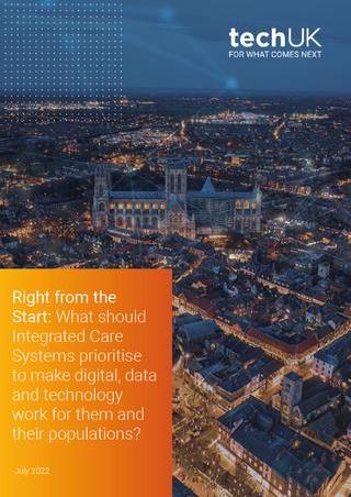
Right from the start: What should Integrated Care Systems prioritise to make digital, data and technology work for them and their populations?
techUK - Committed to Climate Action
techUK represent the views of our members on a broad range of policy topics. We work closely with government to develop effective policy and regulatory solutions. In 2022 we continue to lobby for effective green UK regulation on topics as diverse as climate disclosures and energy reporting, to the decarbonisation of energy and mobility. To discuss how we can support you, please visit our Climate Action Hub and click ‘contact us’.


