Mapping the vision for a sustainable city: A case study by Atkins
Edinburgh’s innovative Green Blue Network and its digital geospatial platform is providing a framework to identify opportunities to integrate nature-based solutions in the city at a strategic and local scale.
The city recognises the importance of a connected network of healthy trees, soil, water, and ecosystems supporting health and wellbeing to ensure a future as a thriving and climate resilient place. As a progression from Edinburgh’s Water Vision developed by Julie Waldron Senior Planning Officer (SuDS Champion 2021), Atkins were commissioned to develop a holistic Green Blue Network Strategy for the City of Edinburgh bringing together information from multiple sources to consider climate change adaptation at a strategic level.
The development of a digital geospatial platform was key to this process. This unique platform allows for the first time, open and transparent sharing of information and discussion between multiple stakeholders.
Developing the Green Blue Network Strategy
The landscape-architect led multi-disciplinary team of flood risk and water management specialists, ecologists, environmental scientists, transport planners, and geospatial specialists drew on local knowledge and extensive experience in nature-based solutions to integrate the principles of quality placemaking in all technical outputs.
To ensure quality datasets were heavily critiqued before use, the mapping and analysis was based on robust established methodologies with a rigorous approach to data integrity and management. Live projects developed in parallel also informed the development of the network including the Edinburgh Climate Change Risk Assessment and Edinburgh’s Sustainable Rain Water Management Guidance (shortlisted for an LI Excellence award in 2020).
Delivering a network for Green Blue Infrastructure
As part of the ongoing project, spatial analysis techniques combined with qualitative assessment have enabled a broad range of Atkins specialists to work together with stakeholders to deliver:
- A strategic flood risk assessment and flood risk modelling to identify hotspots for fluvial and pluvial flooding, detailed assessment of all development areas and identification of opportunities to de-culvert ‘lost’ watercourses.
- An integrated digital platform using Geographic Information System (GIS) to bring together data and information as a baseline for the Green Blue Network and resource to assist planners and decision makers.
- Mapping of Surface Water Flow Paths across the city to identify opportunities for storm water separation using sustainable surface water management to relieve pressure on Edinburgh’s drainage infrastructure, enhancing existing and identifying opportunities for creating new blue green corridors.
- Ecosystem service mapping of air quality, noise, recreation, biodiversity, and land capacity for carbon sequestration, to identify gaps and areas most in need of improvements.
- Identify key opportunities at strategic and local scale that could provide multiple benefits in the form of ecosystem service improvements, sustainable water management and improved connectivity for people and nature.
- Extensive consultation and knowledge-sharing with stakeholders throughout the course of the project to understand priorities, inform the development of the network and agree emerging opportunities.
- Cost /Benefit information to inform prioritisation and programming of ‘Priority Action’ sites to be taken forward for implementation as part of the LDP Action List, co-ordination of planning activities and alignment of investment across multiple stakeholders.
Next steps
Future actions will include examining the project’s opportunity areas within more regional and local green blue networks, linking to work in Edinburgh’s ‘Water Sensitive’ places and proposed active travel routes. This will enhance and safeguard Blue Green Infrastructure, thereby providing benefits for people and nature.
Adapted from first publication: https://www.landscapeinstitute.org/blog/mapping-the-vision-for-a-beautiful-sustainable-city/
The techUK podcast: Innovation in place-based care
In this episode we explore the concept of ‘place’ in care, the principles behind it, the impact of Covid-19 on care delivery, prospects for innovation following the introduction of Integrated Care Systems, examples of industry best practice, and where listeners can go to learn more about ‘place’ and innovation in care.
We were joined by Helena Zaum (Social Care Lead at Microsoft and Chair of techUK’s Social Care Working Group), Scott Cain (Associate at the Connected Places Catapult) and Hannah Groombridge (Healthcare Engagement Manager at Person Centred Software).
This discussion forms part of techUK’s Digital Place Week 2022 activity and features on our recently-launched Social Care Innovation Hub.

Read techUK's latest flagship report, released on Thursday's 'Health and Wellbeing' day:
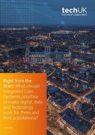
Right from the start: What should Integrated Care Systems prioritise to make digital, data and technology work for them and their populations?
techUK - Committed to Climate Action
Visit our Climate Action Hub to learn more or to register for regular updates.
techUK represent the views of our members on a broad range of policy topics. We work closely with government to develop effective policy and regulatory solutions. In 2022 we continue to lobby for effective green UK regulation on topics as diverse as climate disclosures and energy reporting, to the decarbonisation of energy and mobility. To discuss how we can support you, please visit our Climate Action Hub and click ‘contact us’.


